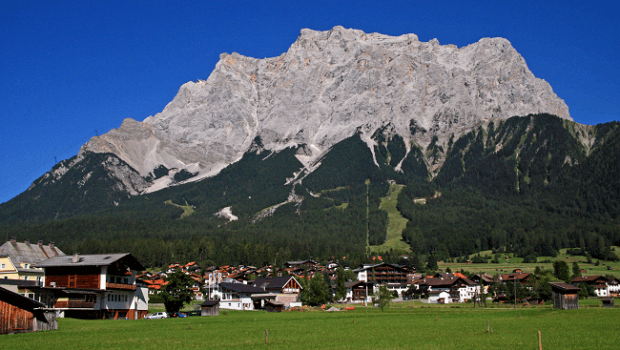
At nearly 2,962 metres or 9,718 feet above the sea level, the Zugspitze is the highest peak of the German lands along with being the same in the Wetterstein Mountains. It is located, rather forms the border between Germany and Austria and is southwards Garmisch-Partenkirchen.
To be on top is almost like having the rush of a lifetime, like having the world at your feet. You get to enjoy not only 20 kilometres worth of piste, but also three glaciers, country homes, impressive panoramic view which will allow you to glance through 400 odd mountain peaks of the region. There is also Germany’s highest church, an igloo village, many restaurants, and lots and lots of snow.
Zugspitze, the name is believed to have been derived out of its avalanche paths or Zugbahnen. These avalanches while flowing down the slope leave certain remnants in the form of rocks and scree.
All around the mountain
Josef Naus on the 27th of August, 1820 was the first individual, in recorded history to have climbed the mountain, Zugspitze. He made this historical feat along with two other people, one being Maier, the survey assistant and the other was Johann Georg Tauschl, his mountain tour guide.
There are also three glaciers on the flanks of Zugspitze. Among the three, two are the largest to be found in Germany. The Northern Schneeferner covers an area of approximately 30.7 hectares and the other, Höllentalferner is spread over an area of 24.7 hectares. The last one, Southern Schneeferner occupies 8.4 hectares.
Towards the southern side of the mountain, Zugspitze is the karst plateau called Zugspitzplatt. This high plateau region is famous for its many caves which attract adventruers from all over Germany and the world.
Furthermore, the mountain is also home to many researchers and scientists who flock here for the purpose of climate research, also there is a weather station which opened up here in 1900.
There are ski and hiking trails that can be followed while scaling towards the summit. If you are of an average body type and of reasonable fitness level, then in that case the climb is a matter of a days’ time. You can also extend the climb by taking pit stops at the numerous mountain huts which are facilitated by the German Alpine Club.
The most challenging route to take is the one that goes through Höllental. This route begins at Hammersbach near Garmisch while going through Höllentalklamm.
Moreover, while scaling from the Austrian side you will have to begin from the village called Ehrwald. There are two paths, first passes straight through the western flank while the other one goes though Ehrwalder Alm and a number of passes. The entire regi0on is maintained by the Austrian Alpine club.
Climate
Zugspitze belongs to a temperate climate zone and it is here that you can feel the legendary winds, the Westerlies in all its glory. The mountain acts as a barrier on the north of the Alps due to which heavy precipitation occurs as the moist air piles up frequently. The wettest month is April in this region. Furthermore, from the south side as well Zugspitze creates a protective barrier. For almost 310 days a year frost can be seen in the region.
The Climb
While climbing atop, passing through the Fern Pass will be required. Also there are three routes which most climbers prefer. The first one passes through the valley of Höllental in the north-eastern direction, the second emerges out of the valley of Reintal in the southeast and the last one originates from the western side over Österreichische Schneekar, the Austrian Cirque.
Among the most popularly known ridge routes runs along the very sharp edged Jubilee Ridge in the Eastern Alps. This route reaches the summit and links Zugspitze with the Hochblassen and the Alpspitze. Rather surprisingly there is no dearth of accommodation for mountaineers there. Especially on the western slopes, here you can take a pit stop at the Wiener-Neustädter Hut and further upwards on the western summit of Zugspitze there is the Münchner Haus.
The Cable Cars
If you are not much of a climber, in that case you can also reach the top of Zugspitze using the three cable cars.
The first one was built in 1926 and is called the Tyrolean Zugspitze Cable Car. Earlier it used to terminate at an arête right below the summit; later on in 1991 the terminus was moved to the summit.
The second is a part of the Bavarian Zugspitze Railway, a rack railway system. It ends at the Zugspitzplatt and passes thought the mountains northern flank. From the end point there is a cable car which then carries the passengers to the top.
The Eibsee Cable car is the third of the cable car networks which transports almost half a million passengers each year. During winters you can find nearly nine ski lifts travelling to and fro in the area.
Geography
The Zugspitze is a part of the Wetterstein mountain range which belongs to the Northern Limestone Alps. Also, the border between Germany and Austria actually passes from right over the mountain. Prior to the establishment of the Shengen Zone, there used to be a border check post on the summit but it was thereon dismantled. Crossing the border is just a matter of a foot step as the crossing is not manned anymore.
Earlier, the height of the mountain was a matter of contestation. The numbers ranged between 2,690 and 2970 metres. Today, as per the survey conducted by the Bavarian State Survey Office, the widely accepted height is 2,962 metres above sea level. The problem of the height arose because of the referencing with the different gauges. The current established numbers are a result of the Amsterdam Gauge, on the other hand, as per the Trieste Gauge, which is prevalent in Austria; the height of the mountain gets reduced by 27 centimetres.
Initially there used to be three peaks of Zugspitze – the east, middle and west summits. But today the one that remains in its original form is the east summit. This summit is also the only amongst the three which falls entirely on the territory of Germany. The middle summit metamorphosed into the station for the cable car in 1930. Whereas, in the place of the west summit a flight control room was built in 1938 for the Wehrmacht, but the plans never materialised and the peak was blown anyway. It is though this summit that the border between Germany and Austria actually passes. Garmisch-Partenkirchen is located at a distance of 11 kilometres in the south-west of the Zugspitze and Ehrwald is towards the east and less than 6 kilometres away.
The municipalities of Grainau and Ehrwald fall under the Bavarian and Tyrol states respectively (of Germany and Austria). These are responsible for Zugspitze massif. On the west of the massif there is the valley of the River Loisach. River Loisach goes around the massif and flows towards the northeast till it curves. On the east there are the two streams: Hammersbach and Partnach and down south there is the Gaistal valley and the river Leutascher Ache. Towards the north, lake Eibsee is located on the foot of the Zugspitze.
The second highest mountain in the region is the Acherkogel which stands tall at 3,008 metres in the Stubai Alps. Due to this Zugspitze enjoys a topographic isolation value of 24.6 kilometres.
You can also find many peaks on the massif of Zugspitze. On the south of the Zugspitzplatt there are arc formations by the Zugspitzeck, Schneefernerkopf, the Wetterspitzen, the Wetterwandeck, the Plattspitze, and the Gatterlköpfen. The massif ends at the Gatterl and there is a wind gab located in between it and the Hochwanner. While going further eastwards, there is the Jubilee Ridge or Jubiläumsgrat over the Höllentalspitzen. While on the other hand the crest of Riffelwandkamm runs towards the northeast over the summits of Riffelwandspitzen and Riffelköpfe which are at a height of 2626 metres and 2459 metres respectively.
In the south and southeast regions is where the plateau of Zugspitzplatt is located and it is below the summit of Zugspitze. The height of the plateau ranges between 2000 and 2650 metres. The rocks here carry a certain formation structure which was a result of weathering, karstification and glaciation. In the following region you can find many formations which were a result of the previous ice age. Here specifically you can find roches moutonnées, dolines and limestone pavements. On the moraines found here, you can clearly see the impact of the different glacial periods. 19th century was the last time that the platt or the plateau was completely covered with ice. Today, particularly its middle and lower regions are a combination of scree, which occupies 52%, bedrock covers 32% and vegetative and soil covering is of about 16%.
The strata of all the mountain buildings consist of sedimentary rocks belonging to the Mesozoic era. The base of the mountain composes of muschelkalk and the upper layers compose of Wetterstein limestone. There are very steep rocks and they reach the heights of 800 metres.
Studies have shown that these rocks were formed in a lagoon because of the presence of marine coralline algae in the Wetterstein. Moreover, the colours of the rocks also keep on varying from grey-white and light grey to being sparkly. Lead and Zinc ores deposits can also be found in some pocketed regions. Mining started between 1827 and 1918, first in the Höllental valley and then spread elsewhere.
Caves are a common site in most mountainous regions. Here in-fact due to the chemical weathering processes quite a number of caves were formed in the due course of time. It was in 1931 when cave explorers first came in the region and slowly as the exploration process expanded it was estimated that there could be more than 300 caves here. Some of the caves here are more than 131 metres deep and it was after an expedition in 1958 that a 260 meter long watercourse was discovered in one of these caves. As per theories, this watercourse is believed to be a source of the river Partnach.
The Flora
There is not much to be found in this regard. But, the meadows of Schachen , the Tieferen Wies near Ehrwald, and in the valleys of Höllental, Gaistal and Leutaschtal – all of these are quite beautiful and brim with colours. It is in-fact the northern slope region which is most rich in species. Mountain pines grow here highlighting the mountainous terrains and these magnificent beauties can reach an elevation of up to 1800 metres. Spruce and fir, honeysuckle, woodruff, poisonous herb paris, meadow-rue, speedwell, dark columbine, alpine clematis, blue and yellow monkshood, stemless carline thistle, false aster, golden cinquefoil, round-leaved saxifrage, wall hawkweed, alpine calamine and alpine forget-me-not flowers as well as Turk’s cap lily and fly orchid thrive in this region. On the southern side as well you can find clusters of pine trees and other rarities such as: lime, birch, rowan, juniper and yew.
Among the most beautiful sites of this region are the fields of raspberries and wild strawberries. Interestingly, alpine poppies and the purple mountain saxifrage also thrive at these great heights.
Fauna
Chamois have made home for themselves in the rocky terrain region of Zugspitze and marmots can be found flourishing in the southern side of the massif. Mountain hares, hazel dormouse, viviparous lizards, black alpine salamander are some of the creatures who have made homes in the region. Among the Alpine birds there are: golden eagle, rock ptarmigan, snow finch, alpine accentor and brambling. Butterflies such as apllo, alpine perlmutter, gossamer-winged butterfly, geometer moth, ringlet and skipper are also a speciality of the region.
In the woods among other things and creatures you will find: red deer, red squirrel, weasel, capercaillie, hazel grouse and black grouse. On the other hand while walking around the glaciers you can quite easily spot water bears and glacier fleas.